
27 beaches from bodega bay to jenner north
From Bodega Bay to Jenner there are 27 beaches that you can visit. Special Note: Every year brings news of deaths as the result of sleeper waves along the Sonoma Coast. And, despite the numerous warning signs along the Sonoma Coast State Beach system, people disregard what seem like unreasonable restrictions.
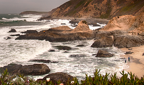
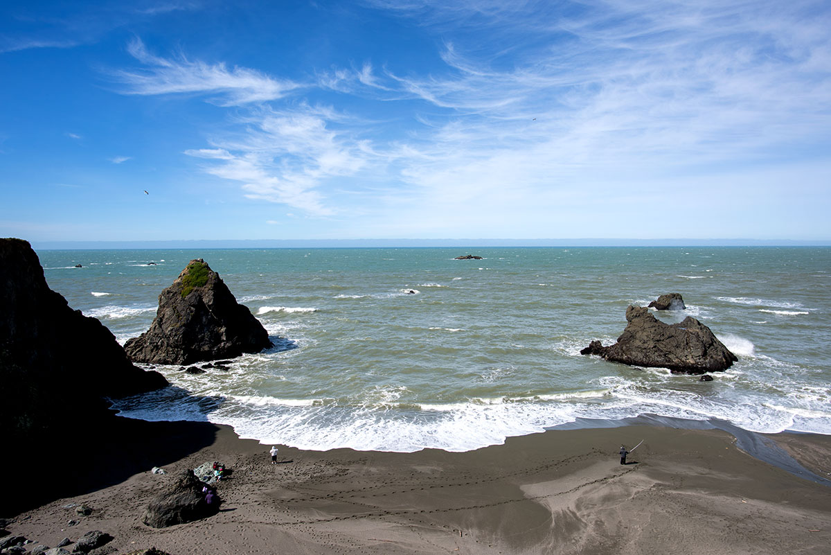
The Sonoma Coast has sleeper waves, also called rogue or sneaker waves, especially in the winter, but possible any time of year. These waves arise out of a seemingly calm ocean without warning, they pull anyone standing too close to the surf line, or climbing rock outcroppings, into the undertow and then out to sea.
The beaches along the Sonoma Coast are not recommended for swimming or wading. The very things that make this area such a spectacular place to look at and enjoy can be lethal to those caught unaware along the
shoreline. Large surf, cold water temperatures, backwash, sudden drop-offs, pounding shore break and dangerous rip currents can turn what seem like safe activities, such as playing near the surf line, wading or climbing on rock outcroppings, deadly.
Here are some guidelines:
Never turn your back to the ocean on the ocean front rocks or anywhere close to the surf line.
Do not climb rock outcroppings, especially if they are posted as dangerous.
Do not allow dogs off-leash or children to play in the surf.
In general, stay 50' above the surf line, especially in winter.
When hiking on the bluffs, stay away from the edge of the bluff and do not attempt to climb down the bluff. The shale formations of bluffs and rocks are unstable and unsafe for climbing. Stay on trails and heed fences and warning signs.
Photos Copyright Francesca Scalpi
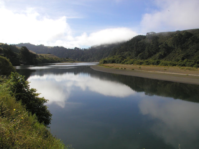
Bodega Head is the prominent rocky point that protects Bodega Harbor from the west.
Horseshoe Cove is a stunning deep cove on Bodega Head near Bodega Bay, CA.
Pinnacle Gulch Beach is a hidden beach at the bottom of Pinnacle Gulch in the Bodega Harbor housing community in Bodega Bay.
Shorttail Gulch Beach is a hidden beach in the housing community Bodega Harbor in the town of Bodega Bay.
Campbell Cove Beach is a sandy spot on Bodega Head just inside the entrance to Bodega Harbor in Bodega Bay.
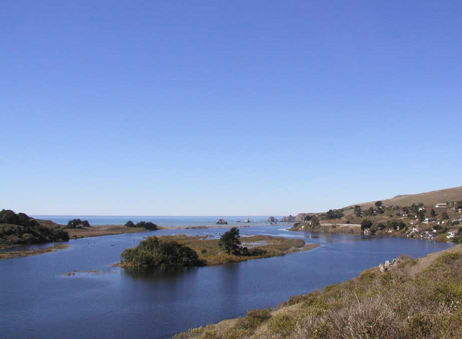
Doran Beach in Doran Regional Park is located along the spit at the entrance to Bodega Harbor from Bodega Bay. Doran Spit is a great place to view the bay, the harbor, and Bodega Head. The wide beach on the bay is about two miles long and makes a wonderful beach walking route. The harbor side beach is narrow, especially at high tide. All over the spit are trails that meander through the dunes for more walking options.
Bodega Dunes is a large state park campground and coastal dunes structure in the town of Bodega Bay.
South Salmon Creek Beach is between Bodega Dunes and Salmon Creek just north of the town of Bodega Bay.
North Salmon Creek Beach is right off Coast Highway 1 just north of Bodega Bay.
Miwok Beach is a tiny beach named after the Coast Miwok Native Americans who lived in this southern portion of Sonoma County long ago.
Coleman Beach is one of many small pocket beaches within Sonoma Coast State Park north of Bodega Bay.
Arched Rock Beach is named for the big rock with a hole in it that is visible to the north.
Carmet Beach is a narrow rocky beach in front of the small housing community of Carmet north of Bodega Bay, CA.
Schoolhouse Beach is one of the wider and nicer beaches along this stretch of the Sonoma Coast between Bodega Bay and the Russian River.
Portuguese Beach is a long wide beach between Bodega Bay and the Russian River in Sonoma County. It’s one of the largest sandy beaches in the area.
Scotty Creek Beach is an excellent pebbly beach where Scotty Creek flows under Highway 1 and enters the Pacific. It’s located about halfway between the towns of Bodega Bay and Jenner in Sonoma County.
Gleason is a narrow rocky beach south of Duncans Landing along the Sonoma County coast.
Rock Point Beach is a tiny sandy spot amongst huge rocks just south of Duncan’s Landing along the Sonoma County shoreline.
Duncan’s Landing is located about half-way between Bodega Bay and Jenner along the Sonoma County coastline.
Wrights Beach is the largest sandy beach between Bodega Bay and the Russian River along in Sonoma County.
Furlong Gulch Beach is a Sonoma Coast State Park State Beach located where Furlong Gulch Creek drains into the Pacific.
Shell Beach is is a narrow rocky beach in Sonoma County just south of the Russian River and the small town of Jenner.
Blind Beach is located south of Jenner and the Russian River in Sonoma County. It’s a long narrow beach that is great for beachcombing and fishing.
Goat Rock Beach is located between Goat Rock Point and the Russian River along the Sonoma County shore near the town of Jenner.
Willow Creek Beach is located on the sandy banks of the Russian River near the town of Jenner.
Fish Head Beach is a narrow driftwood-covered beach about two miles north of the visitor center in Jenner, California on the Sonoma County coast.
Russian Gulch is a pebbly beach in a deep cove where Russian Gulch Creek flows into the Pacific north of Jenner.

Hiking Trails
There are some of the great hiking trails from Bodega Bay, Jenner to Fort Ross. Enjoy spectacular scenery along the bluffs, journey along the rift line of the San Andreas Fault, visit the site of California's first shipyard, sit atop the Jenner Grade on a high plateau 600 feet above the sea, see migrating whales, a colony of harbor seals, through redwood forest to an overlook of the Russian River and then to an overlook of the entire southern Sonoma Coast.
For maps and detailed information on hiking trails along the Sonoma Coast.
SONOMA LAND TRUST - JENNER HEADLANDS

5,630-acre property - More than 1,500 people have visited the property on more than 80 hikes. Along with outings led by Sonoma Land Trust and The Wildlands Conservancy, partner organizations, including Stewards of the Coast and Redwoods, Coastwalk and LandPaths.
Click here for more information on this website about the Jenner Headlands Preserve. Additional links provided below on the organizations involved in the Preserve.
Photo Copyright Francesca Scalpi
Jenner Headlands Facebook Page
Jenner Headlands Website
Press Democrat: Public Access Plans for Jenner Headlands
BODEGA HEAD
A hike on Bodega Head offers some of the most beautiful vistas in the county. On a clear day you can see a panoramic view of Bodega Bay, the Sonoma and Marin coasts, Point Reyes peninsula, Tomales Point and beyond. Bodega Head has a relatively short hiking trail that goes around the headland. This trail has spectacular views of the Pacific Ocean, Bodega Harbor, and the town of Bodega Bay. There is another trail that connects with the trail system found in the Bodega Dunes section of the park. Here you can walk along the headlands and on the beach. Bodega Head is actually a runaway granite outcropping from lands 300 miles south of here. Geologists believe it was once a part of the Tehachapi Mountains, at the southern end of the Sierra-Nevadas.
For maps and detailed information on hiking trails along the Sonoma Coast.


Photos Copyright Francesca Scalpi
KORTUM TRAIL
The Kortum Trail - 4.3 mile trail between Bodega Bay and Jenner, California. This is part of a trail system that leads along the coast of Sonoma County named for Bill Kortum, a Petaluma veterinarian, who was the leader in the fight to guarantee access to the coastline for the public over developed private lands. One of the most popular local hikes, this is an easy, flat headlands trail, 3 ¾ mile round trip for a two hour walk. Enjoy spectacular scenery along the bluffs, followed by a descent to Shell Beach. In the grasslands you might see Douglas iris, lupine, and Indian paintbrush thru April and June.
For maps and detailed information on hiking trails along the Sonoma Coast.


Photos Copyright by Francesca Scalpi
SONOMA COAST STATE BEACH
Sonoma Coast State Beach is actually a series of beaches separated by rock bluffs and headlands, extends 17 miles from Bodega Head to Vista Trail located 4 miles north of Jenner.
Beachcombers, fishermen, sunbathers and picnickers can access the beach from more than a dozen points along coast Highway 1. The craggy coastline includes secluded coves, reefs, fertile tide pools, rugged headlands, natural rock arches, sand dunes, and wildflower-covered meadows.
Long sandy beaches below rugged headlands, a craggy coastline with natural arches and secluded coves are features that make Sonoma Coast State Park one of California's most scenic attractions.
While the north coast weather can be foggy in the summer, it usually burns off by midday and the cool ocean breezes make the Sonoma Coast a haven for visitors seeking to escape the inland heat.
Maps Courtesy of California State Parks
For maps and detailed information on hiking trails along the Sonoma Coast.
FURLONG GULCH BEACH
Furlong Gulch Beach is a Sonoma Coast State Park State Beach located where Furlong Gulch Creek drains into the Pacific. It is between Shell Beach and the north end of Wrights Beach. Furlong Gulch Beach isn’t big, but it’s a picturesque spot with many rocks and seastacks in the surf, especially looking north.
For maps and detailed information on hiking trails along the Sonoma Coast.


Photos Copyright Francesca Scalpi
RED HILL TRAIL
From Shell Beach, which can be reached by either of the two hikes above or by car (located on Highway One with its own parking lot), take the Pomo Canyon Trail on the east side of the highway. The Red Hill Trail branches off the Pomo Canyon Trail and climbs through an old ranch to amazing vistas of Willow Creek and Russian River canyons, along with distant mountains and the coast.
POMO CANYON CAMPGROUNDS
SPECIAL NOTE:
This summer 2016 Pomo Canyon Environmental 21-site Campground, part of the Sonoma Coast State Park will be open.
POMO CANYON TO SHELL BEACH HIKE
You can start at Shell Beach at take the trail through Pomo Canyon Campgrounds. Another options is to start at Pomo Canyon Campgrounds and end at Shell Beach. Some hikers will do the entire round trip or park one of their cars at the end destination an only hike one way.
For maps and detailed information on hiking trails along the Sonoma Coast.
SHELL BEACH TO WRIGHTS BEACH
Shell beach is a scenic and geological jewel on the northern Sonoma County coast. From Shell Beach, you can hike south 2 ½ miles to Wright's Beach. You'll cross five creeks along the way; the round trip will take two to three hours. There is a campground at Wright's Beach, with a wheelchair-accessible path to the beach.
For maps and detailed information on hiking trails along the Sonoma Coast.
KOLMER GULCH TRAIL - FORT ROSS
In the center of Fort Ross State Historic Park is the Fort Ross Orchard, a three-acre garden filled with apple, plum, and pear trees dating back to 1814. Across the road from the historic orchard is the Stanley Spyra Memorial Grove. The grove has the world’s oldest known second-growth coastal redwoods. The San Andreas Fault runs through the orchard and the memorial grove. During the infamous 1906 San Francisco earthquake, the ground suddenly shifted more than 12 feet. The grove has visible remnants of the earthquake, including offset creeks, sag ponds (water-filled depressions along the fault), escarpments, and damaged trees.
For maps and detailed information on hiking trails along the Sonoma Coast.
FORT ROSS CREEK TRAIL
The Ft. Ross Creek hike takes you from the parking lot down to the cove behind Ft. Ross, the site of California's first shipyard (see the interesting reconstruction in the Visitor Center).
For maps and detailed information on hiking trails along the Sonoma Coast.
Fort Ross State Historic Park Reef - Campground & Day-Use Area
Hiking Trails: Several interesting hiking trails are available. You can hike from the campgrounds along the coast to Fort Ross.There are many pathways to areas along the coast to surf and go tide-pooling. Always check you tide charts and watch for sleeper waves.
For maps and detailed information on hiking trails along the Sonoma Coast.
Kruse Rhododendron State Natural Reserve
To the trail-head 34899 Kruse Ranch Road • Cazadero - 38.593635, -123.339471
For maps and detailed information on hiking trails along the Sonoma Coast.
The Estero Americano Coast Preserve
A coastal prairie with three-quarter-mile stretch of Pacific Ocean coastline. The property includes a one-mile section along the mouth of the Estero Americano estuary.
Flyover Video: https://www.youtube.com/watch?v=KUERF0lKB9c

OVERVIEW
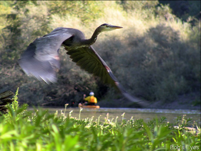
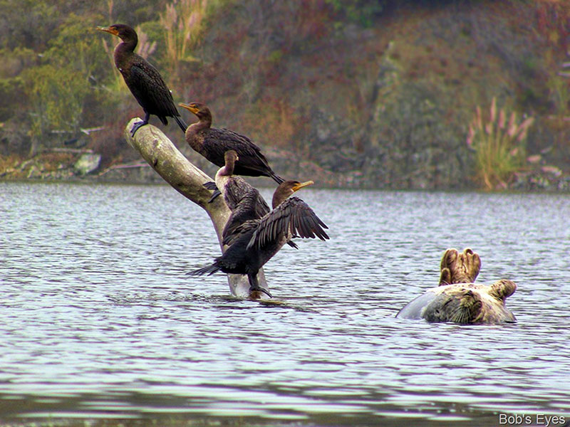
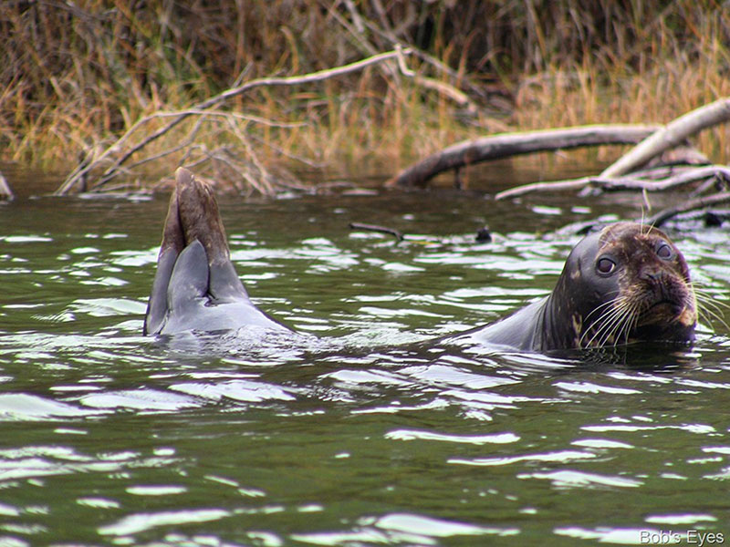
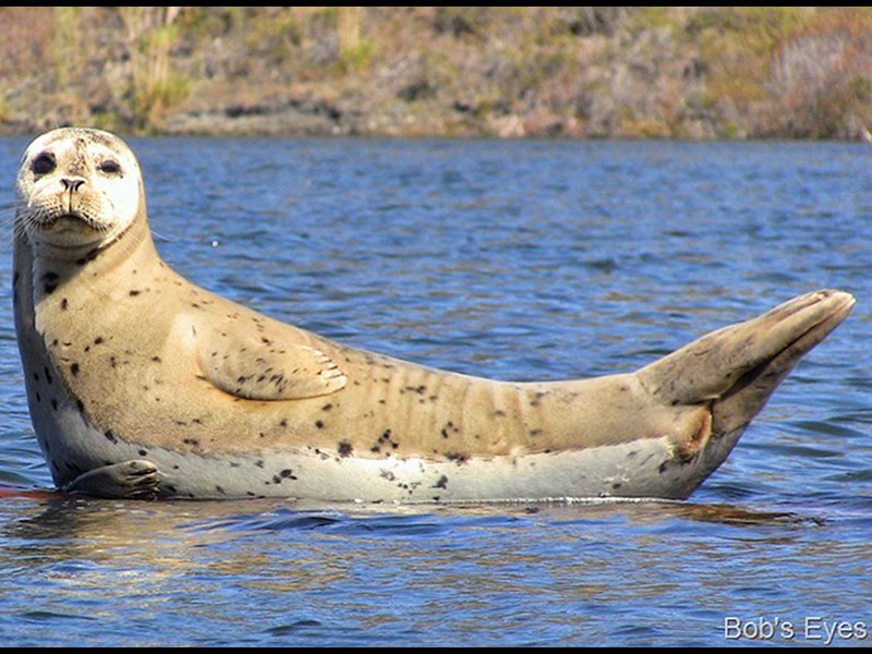
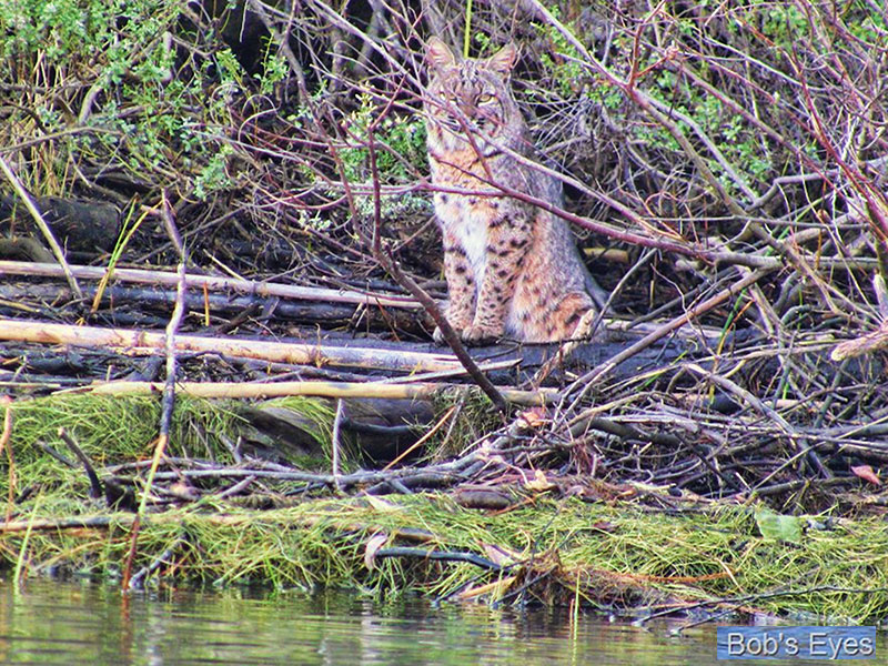
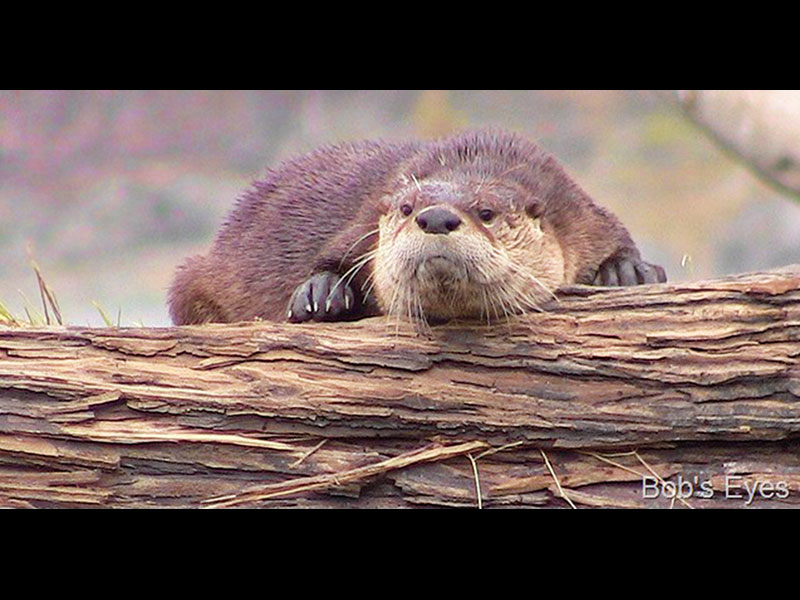
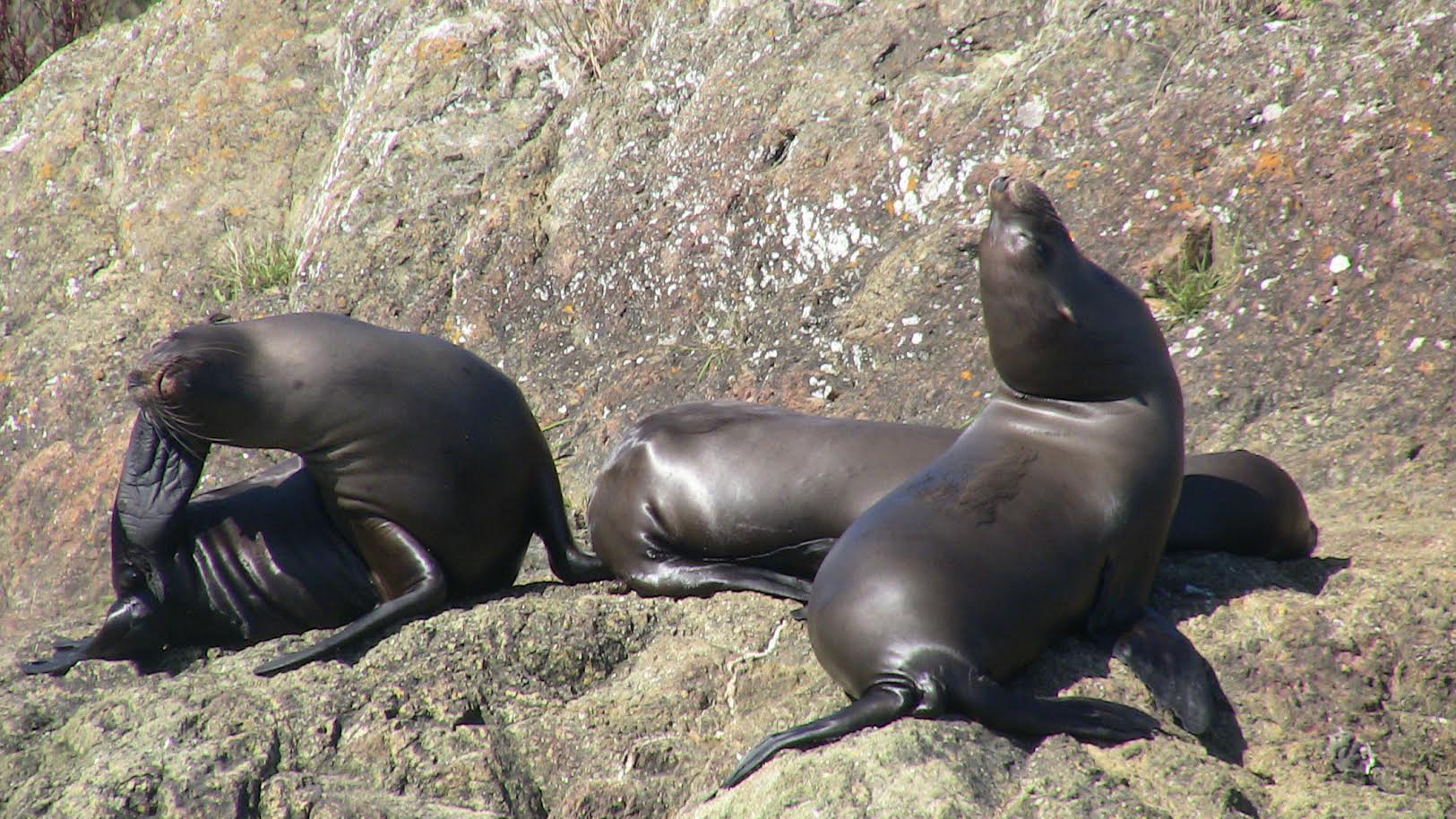
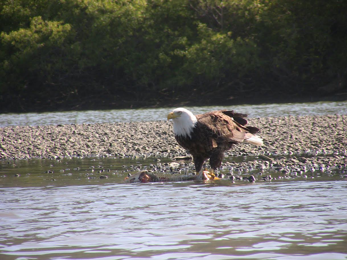
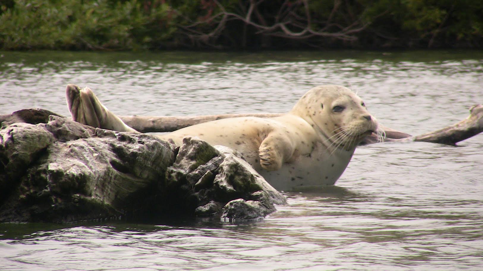
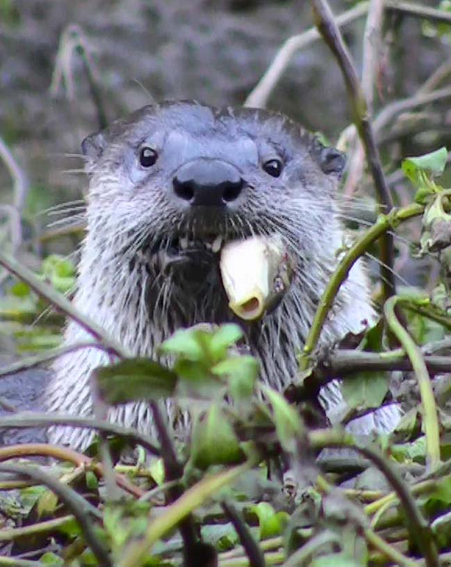
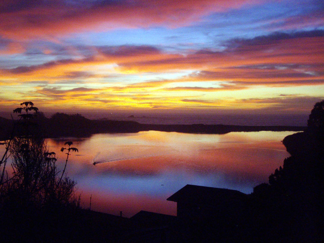
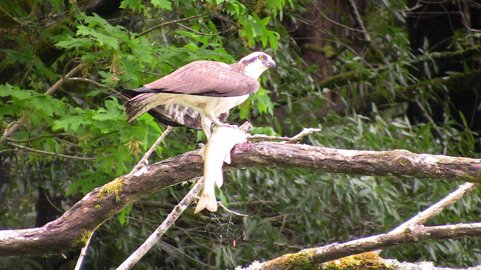
There are many places to kayak on the Sonoma Coast. You can kayak up the Russian River from Jenner to Healdsburg stopping along the way. You can explore the Jenner estuary around Penny Island and see Bald Eagles, Osprey, Herons, River Otters, Bobcats on the shore and Harbor Seals. There is Ocean Kayaking along Doran beach. Our local outfitter WaterTreks has guided tours including Morning, Sunset, Full Moon and Seasonal Glowing Plankton. Bodega Bay Surf Shop offers tours of Estero Americano, Seal Rock and Fort Ross Cove.
CONDITIONS
The river mouth is dynamic and changes with the tides each day as well as changes with wind direction, ocean swells and river flows often thorough out the year. There are times when the mouth of the Russian River becomes closed or open in a different location. Be aware oftidal currents near the mouth of the River. Some times the river mouth is open by the jetty or further north. Coastal temperatures can fluctuate. There will be difference as you paddle from the Jenner estuary upstream towards Monte Rio and Guerneville. There are also seasonal afternoon winds from April to July. You may experience fluctuating mist and fog locally. December and March is the rainy season. River currents may be strong after each rain storm.
SELF GUIDED TOUR
Estero Americano: Valley Ford to Bodega Bay
The trip is 6 miles (one way) from the put-in point at the bridge 1 mile south of Valley Ford, down to the ocean in Bodega Bay. It is a shallow-water route of outstanding pastoral beauty. Sand dunes inside the ocean beach destination offer wind protection for camping out. It is an easy trip, as long as you work with wind and tides. There is a good, halfway haul-out point at the Whale’s Tail for those who want a shorter, relaxing trip. The estero is a riparian corridor in which many species of raptors hunt on their migration and others breed; it is also frequently visited by white pelicans. The Point Reyes Tule elk herd roams over the high ground where the estero approaches the sea, and white-tailed deer often browse close to the water.
Russian River:
Winding past hills covered in coastal scrub at the mouth, this peaceful ribbon of water meanders through willow thickets and dense evergreen stands as you continue inland. The relative solitude, scenery, and wildlife along this stretch make it an excellent place for an easy day trip, despite the proximity of Highway 116, which runs the length of the river. A variety of birds—from cormorants and ducks to shorebirds and osprey—are commonly seen along with harbor seal and the occasional river otter. Upriver, currents are generally easy to paddle against and helpful when returning against the afternoon winds. Kayak camping is available at a hike-in environmental camp near the put in, as well as at two drive-in private campgrounds further upstream. Although camping here is easily accessible to beginners, it is not very isolated. For more skilled and adventurous paddlers seeking solitude, the coastline beyond the river mouth is much more remote—thick with cliffs, rock gardens, sea stacks, and surf.
The Russian River: Jenner to Rien's Sandy Beach
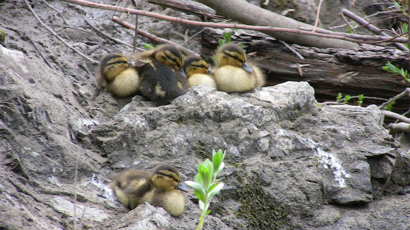
Suitable for canoe or kayak, this trip covers the Russian River Estuary, where it enters the Pacific Ocean below Jenner to Rien’s Sandy Beach, 6.75 miles upstream. Jenner is only 8 miles south of Fort Ross, which was the stronghold of the Russian American Fur Company. Seal and otter hunting supported the Russians in this region until 1841. Now, the Russian River is a popular summer scene for swimming and boating, and noted for its winter steelhead fishing. There are two good commercial campsites and one “environmental” site available year round; all three have direct access to the water. Wildlife highlights include “fishhawks,” ospreys, and the biggest of the “sawbills,” American mergansers. You may get lucky and see coyotes or a bobcat from your kayak
Favorite stops along the river from Jenner to Villa Grande: Bob's Eye Blog
Penny Island channel east, water level permitting, stop anyway.
Otter's log, on the right, south side of the river.
Eagle landing, on the right, south shore.
Paddy's rock, left side of the river, north side, across from Eagle’s landing.
Willow Creek entrance, on the right, south shore, also a boat launch area.
Seal Heaven, on the left, north shore
Markham hole, on the left, north shore
Casini Ripple, in the middle of the river, at Casini Ranch, stop above the ripple on the left side, south shore and watch for fish crossing the ripple when they are running.
Moscow hole at Rein’s beach, on the right, just past Rein’s beach
Villa Grande hole onthe left at Villa Grande.
Click here to view his blog
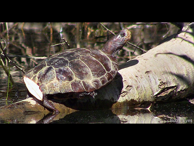
WILDLIFE PHOTOS COURTESY OF BOB'S EYE BLOG

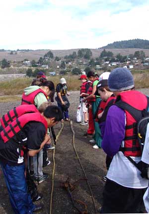
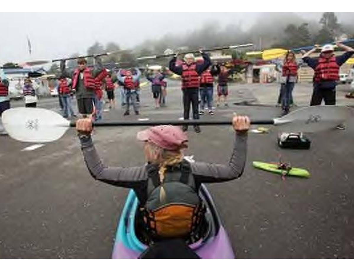
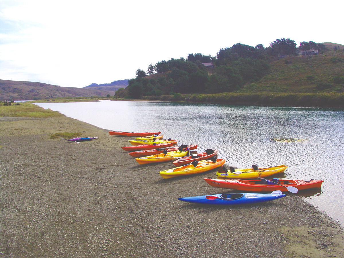
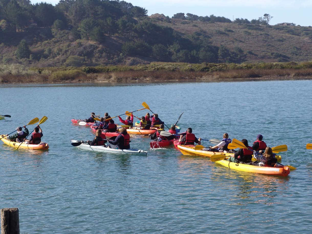
KAYAKING PHOTOS - COURTESY OF WATERTREKS
Exploratory Kayak Tours and Rentals:
WaterTreks:
Learn, Explore, Volunteer, Contribute: Kayak Rentals, Tours and Certified Instruction or Shuttled Self Guided Hikes: Several Routes from 2 hours to 4 Days: Most activities focus on our State Park Biological Preserve in the town of "Jenner By the Sea". Our activities include tips on enjoying the local plant and wildlife; and they help fund paid internships for future "outdoor" emergency service personnel, researchers, educators and guides as well as our education and research programs. Guided tours include Morning, Sunset, Full Moon and Seasonal Glowing Plankton; where on the most intense nights you can see the trails of fish, harbor seals and other estuary life moving in the water. We're are also a favorite with schools, scouts and team building or family groups. Join us on the water for a unique Sonoma County perspective. Photos Copyright Watertreks
www.watertreks.com - 707.865.2249
Kayak Rentals:
Lotus Kayaks:
Russian River and Estuary. Look for the Lotus Kayak rental sign and ask for John or call: 707-865-9604 to arrange for rentals in advance.

SURFING, PADDLEBOARD AND KITE SURFING
SURF SPOTS
Black Point Beach (North of Jenner), Russian River Mouth, Salmon Creek and Doran Beach (South of Jenner).
Best time of year is Fall for scoring clean surf and sunny skies. Fall can also see some gnarly winter-like storms, with 20-foot waves and heavy rainfall. The prevailing winds are usually the lightest this time of year, so if you're going to visit lower Northern California at all, come during the months of September through November.
wannaSurf
http://www.wannasurf.com/spot/North_America/USA/California/Sonoma/index.html
Surf Conditions: Bodega Buoy - Station 46013 BODEGA BAY - 48NM NNW of San Francisco, CA
Weather: NOAA Coastal Weather Forecast
Surf Reports:
Pacific Waverider Surf Reports
Wetsand.com reports
Surfline reports
Surfboard Rentals:
Bodega Bay Surf Shack, 1400 Highway 1, Bodega Bay, CA 94923
Cross Streets: Near the intersection of Highway 1 and Bodega Ave
(707) 875-3944
bodegabaysurf.com
Northern Light Surf Shop, 17191 Bodega Hwy, Bodega, CA 94922
Cross Streets: Near the intersection of Bodega Hwy and Salmon Creek Rd
(707) 876-3032
northernlightsurf.com
Kool City Surf Shop
20396 Bohemian Hwy, Monte Rio, CA 95462
Cross Streets: Near the intersection of Bohemian Hwy and Church St
(707) 865-9613
Sonoma Coast Surf Shop, 9 4th St, Petaluma, CA 94952
Cross Streets: Between Kentucky St/A St and B St
(707) 763-3860
sonomacoastsurfshop.com
Bodega Bay serves as a western gateway to some of the most renowned wine country in the world.There are only four towns on the entire Sonoma coast, in between which lie miles and miles of either inaccessible and/or unsurfable beaches. There is a jewel or two, but these are really only ridden and scored by the locals.
As they lie within the boundary of the official Red Triangle (Santa Cruz to the Farallon Islands to Bodega Bay), Marin and Sonoma counties are shark central. This coast has lots of rocks, seaweed and places for seals and sea lions to hang around, so the sharks know where to go. Unfortunately, the best surf is where most of the sea life exists, so every session can be seen as a roll of the dice. Fall is the best time for scoring clean surf and sunny skies.The prevailing winds are usually the lightest this time of year, so if you're going to visit lower Northern California to surf, come during the months of September through November.
RUSSIAN RIVERMOUTH - JENNER
The Russian Rivermouth will either love you or hate you, since it's fickle and schizophrenic with its dependency on proper sand flow to create an epic bar. The sandspit here is home, sweet home to a large posse of harbor seals, which resemble oversize grubs wriggling about on the sand (it's illegal for you to go near them). Needless to say, the sharks ignore the laws of the land and take their pick of the litter when they feel like it, and we all know what that means -- keep those feet up. When the Rivermouth's on, the wave itself is typically a right barrel, shallow with lots of currents. It can be insanely good, but really only during the summer and early autumn. Big swells don't mix with the Russian Rivermouth, so wait for a small, clean pulse accompanied by light east winds and an incoming tide.
Best Tide:Incoming
Best Swell Direction: W, SW
Best Size: Waist-high to a couple of feet overhead
Best Wind: E, NE
Perfect-O-Meter: 2 to 6 (1=Lake Erie; 10=Jeffreys Bay)
Bottom: Sand
Ability Level: Intermediate to advanced
Bring Your: Shortboard and shark repellent
Best Season: Late summer/early fall
Access: Easy. At the sign on Highway 1 signaling toward Goat Rock, turn west onto State Park Road and drive to its end. From there, you simply hop out of your car and walk over to the mouth.
Crowd Factor: You can have it to yourself, or share it with a few locals.
Bicep Burn: 3 (1=1ft Waikiki; 10=15ft Ocean Beach)
Poo Patrol: 1 to 4 (1=clean; 10=turds in the lineup)
Shark Danger: 11 on a scale of 1-10 (1=none; 10=bring an iron cage)
Hazards: Sharks
SALMON CREEK
The most popular surfing spot in the county -- powerful beachbreak resembling San Francisco's Ocean Beach. The tiny enclave of Salmon Creek is quite humble -- a cluster saltbox homes fronting piles of crab pots and fishing buoys. Most surfers frequenting Salmon Creek Beach drive from inland areas like Santa Rosa and Sebastopol, much to the dismay of coastline natives. Thus, you get your mix here of the clean-shaven, new-Toyota-truck types from the big city versus hard-edged, rusty-pickup-driving Bodega fishermen. Once you drive north of Salmon Creek, however, the glitter fades and the isolation increases. The surf? Well, Salmon Creek, as mentioned, is a heavy wave that will kick your ass no matter how many times you've surfed Puerto Escondido. Getting outside can be tougher than escaping from Alcatraz, but there's usually a couple of natural paddling channels if the swell is peaky enough. Salmon Creek can hold big swells: 10 to 12 feet on Buoy 13. This doesn't mean that you'll be able to make it out or even consider a go-out, but it's worth a look. The currents and undertow are notorious, too, and it blows out fairly easily. The area in front of the parking lot is the most heavily trodden peak, but you can always find your own wave with a short walk to the south. If you're accustomed to riding big, burly beachbreaks, Salmon Creek is for you. If you're accustomed to riding waist-high mushburgers at San Onofre, stick to Doran farther south.
Best Tide: High
Best Swell Direction: Whatever's peaky, crossed up swells
Best Size: Chest-high to double-overhead plus
Best Wind: E
Perfect-O-Meter: 2 to 5 (1=Lake Erie; 10=Jeffreys Bay)
Bottom: Sand
Ability Level: Intermediate to advanced
Bring Your: shortboard/funboard if it's smallish, gun if it's pumping
Best Season: Fall
Access:
For Bean Avenue, turn onto Bean Avenue off Highway 1 and drive to its end. For Salmon Creek proper, pull into the paved North Salmon Creek Beach parking lot off Highway 1, one mile north of Bodega Bay. Take one of the trails down to the sand.
Crowd Factor: Can see a fair-sized group of guys, but, again, there's plenty of room.
Bicep Burn: 3 to 10. Heavy. (1=1ft Waikiki; 10=15ft Ocean Beach)
Poo Patrol: 2 (1=clean; 10=turds in the lineup)
Shark Danger: 10 (1=none; 10=bring an iron cage)
Hazards: Seeing how this break lies at the mouth of a major creek, you can be certain that there's a clear and present shark danger. There have been three attacks here since 2000.
DORAN BEACH
Located one mile south of downtown Bodega Bay, Doran is a sheltered, shallow and powerful beachbreak that's usually closed out. It faces south, so northwest winds howl offshore here, making it a springtime spot. Doran is popular when the surf is too big everywhere else, but forget about it if the winds are from the south. Favored by novices and bodyboarders who commute from the inland cities of Petaluma, Santa Rosa and Sebastopol, Doran will make anyone feel like he's WCT status. Beginners are most at home here than at any other spot in the county due to its shallowness and shelter, but Doran can dish up some pounding tubes, so beware -- it wouldn't be difficult to break your neck or bust a fin out on the bottom here.
Best Tide: Higher
Best Swell Direction: S, or long period W and NW
Best Size: Chest high to a couple feet overhead
Best Wind: N, NW
Perfect-O-Meter: 2 (1=Lake Erie; 10=Jeffreys Bay)
Bottom: Sand
Ability Level: Beginner to intermediate
Bring Your: Shortboard, skimboard or bodyboard
Best Season: Spring
Access: Exit Highway 1 onto Doran Beach Road
Crowd Factor: Unless it's north winds and peaky, hardly anybody will be in the water here
Bicep Burn: 2 (1=1ft Waikiki; 10=15ft Ocean Beach)
Poo Patrol: 2 (1=clean; 10=turds in the lineup)
Shark Danger: 6 (1=none; 10=bring an iron cage)
Hazards: A fairly safe spot. Except for an occasional shark.

Sonoma Coast Diving

Abalone diving offers you a chance to get into the beautiful California waters and experience nature first-hand. Floating on the surface in green-blue waters among seals and sea birds, and diving down among kelp and schools of fish, you truly feel a closeness to nature that's hard to find elsewhere. Because free diving (snorkeling) is the only method allowed when hunting for Abalone, there is a moderate level of skill involved. If you're new to California diving or diving for abalone there are several local dive shops offer Abalone Diving classes.
WARNING: Every year divers are killed in the pursuit of our abalone. Some problems are getting tangled in kelp or stuck in rock crevices, poorly estimating ocean and weather conditions, a diver going out and getting exhausted in a rough ocean, typically with too much lead on the weight belt, "shallow water blackout" which can occur on the trip back to the surface and please note ocean conditions can change rapidly.
Click here to find out about Abalone Report Card Data and regulations.
Top Dive Sites: In Mendocino the "top" sites are Russian Gulch, Caspar, Van Damme. All run south from Ft. Bragg. In Sonoma, the "top" sites are Ft. Ross, Stillwater Cove and Gerstle Cove (in Salt Point State Park). All are north of Jenner and south of Sea Ranch.
Dive Shops:
Sonoma Coast Divers - Rohnert Park
Pinnacles Dive Center - Santa Rosa

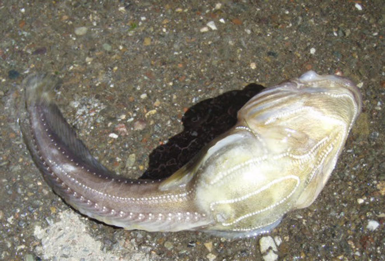
Sports Fishing - Russian River and Pacific Ocean
Fishing in western Sonoma County is primarily devoted to fishing in the Russian River and deep-sea fishing, along with crabbing, out of Bodega Bay on the Sonoma Coast

Ocean Fishing:
Fish found ocean fishing include: Salmon, Crab, Rock Cod,Halibut,
Ling Cod, Albacore, Humboldt Squid
Charters out of Bodega Bay
Miss Anita Fishing - 707-875-3474 http://www.missanitafishingcharters.com/
Fish On Bait & Tackle 707-875-2323 http://www.bodegabayfishing.com/
Bodega Charters - (707) 875-3495 http://www.bodegacharters.com/
NorCal Sport Fishing Adventures 707.228.8322 http://norcalsportfishingadventures.com/
Russian River Fishing:
Fish found in the Russian River include: Large and Small Mouth Bass, Striped Bass, Bluegill, Catfish, Shad, Chinook Salmon, Coho Salmon, Steelhead Trout
The Russian River is a year-round fishery. Summertime is prime fishing for Smallmouth Bass, Bluegill, and Catfish. Early fall begins the small Steelhead run and the larger Steelhead begin to run in November, continuing through April. April through June is Shad season, with Catfish beginning to be plentiful as well.
On the river, you can fish from the bank or standing in the river (in winter with waders), or you can fish from a boat. Small motor boats are allowed on the river, but most people bring or rent a canoe or kayak and paddle to a good fishing spot.
The winter brings the most exciting fishing. Small Steelhead Trout (up to 4 lbs) migrate up the river in late September and October. They stay in the lower river and can be taken with light tackle or a 5 or 6 weight fly rod. The large Steelhead (6 to 14 lbs, occasionally larger) start their migration in late October and November, running into early April.
There are a number of favored fishing spots. One is at Wohler Bridge between Forestville and Healdsburg, just off River Road. The other is Steelhead Beach in Forestville off River Road. Both spots provide river access at multiple points and are mostly quiet and un-traveled. Others are Lucky Bend in Guerneville, about a mile west of the Guerneville Bridge, and the area just east of the Guerneville bridge. - www.russianriversoutdoors.com
Check with the California Fish and Wildlife for regulation for fishing ocean and freshwater fish.
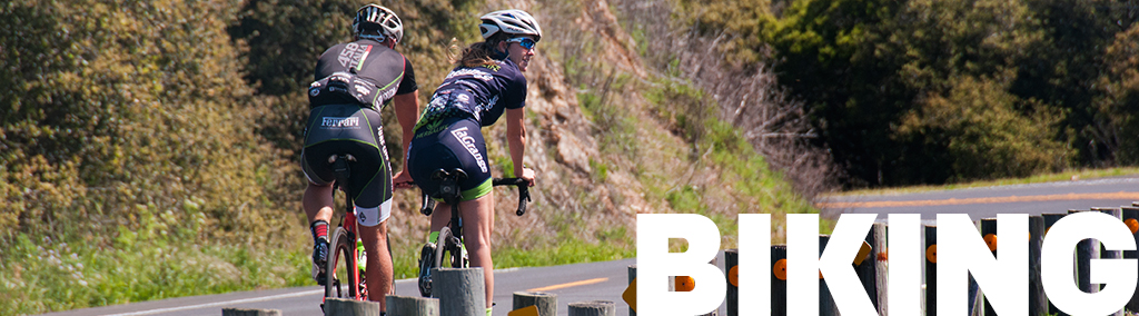
The IRONMAN 70.3 Vineman Triathlon
Consists of a 1.2 mile swim, 56 mile bike, and 13.1 mile run triathlon and is a qualifier for the 2015 IRONMAN 70.3 World Championship.The point-to-point event begins at Johnson's Beach in Guerneville and takes entrants past hundreds of vineyards and dozens of wineries before it finishes up at Windsor High School in Windsor. The course is a tour of Sonoma County's beautiful wine country, passing through four different grape growing regions: the Russian River Region, the Dry Creek Valley, the Alexander Valley, and Chalk Hill.
http://www.vineman.com/IRONMAN_70_3_Vineman.htm
Monte Rio Vineman:
The swim will be staged in the Russian River. Thebike course follows the Russian River and travels through the old growth redwood trees.Those competing in the Olympic distance race will also ride out to the picturesque coastal town of Jenner and back. The run is held on the course that once was the home of the Moscow Road Race, a popular run from the running boom days of the 1970's. The run course is flat, fast, and shaded almost the entire way.
http://www.vineman.com/Vineman__Monte_Rio.htm
Full Vineman Triathlon
Swim 2.4 miles, bike 112 miles and run 26.2 miles through beautiful Sonoma County's wine country. The Vineman course is a tour of Sonoma County vineyards & wineries, which passes through five distinct regions. The swim takes place at Johnson’s Beach in the Russian River, one of the most rustic swim venues you’ll see in the sport. The bike course is a mix of terrain, and travels through the Russian River, Dry Creek, Alexander Valley, and Chalk Hill grape growing regions. With slightly less than 4000 feet of climbing for the entire bike course athletes find the course to be challenging but not overwhelming. The three loop, out-and-back, run course takes the athletes from the finish area through scenic country roads of Sonoma County.
http://www.vineman.com/triathlon.htm
Vineman AquaBike
Full Vineman AquaBike: Swim 2.4 Miles / Bike 112 Miles
Half Vineman AquaBike: Swim 1.2 Miles / Bike 56 Miles
http://www.vineman.com/aquabike.htm